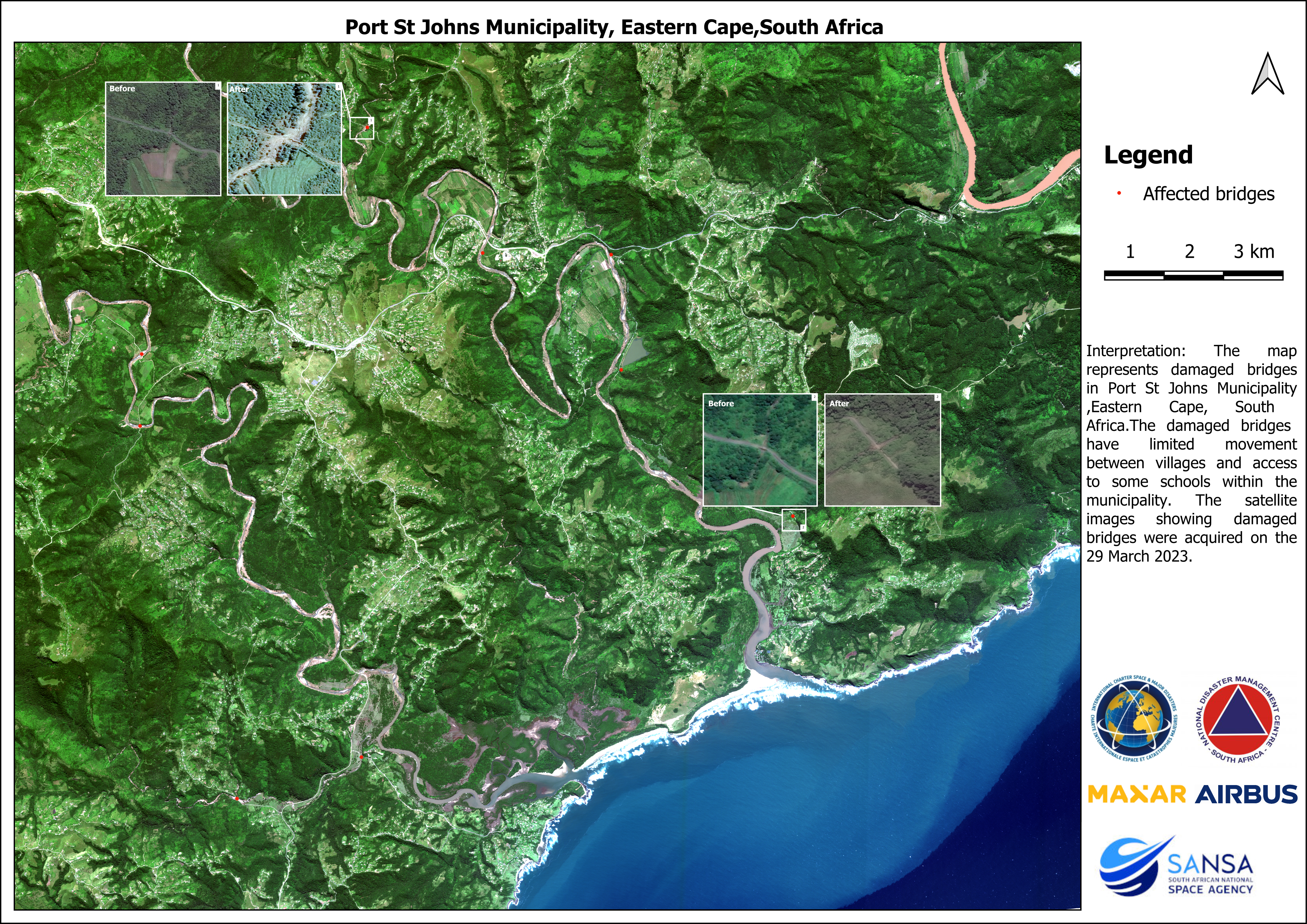
18 Apr The South African National Space Agency’s FREE National Water Quantity Information Service “Mzansi Amanzi”
The South African National Space Agency (SANSA) has a legislative mandate for the acquisition, archiving, processing, and dissemination of satellite imagery, to enable the development of data and information products for the use and benefit of the public sector and