Food Security
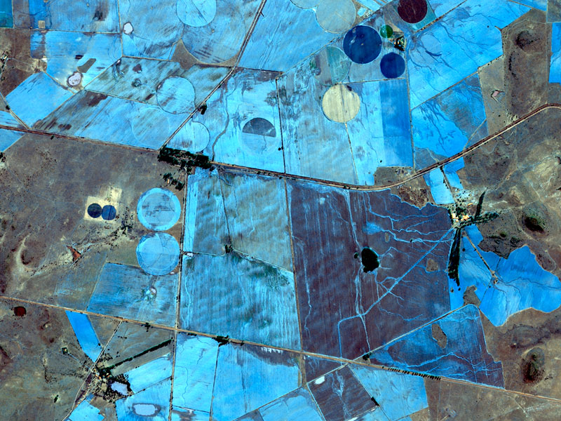
SANSA uses earth observation technology to provide useful information to decision-makers, policy makers, agribusinesses and farmers. For example, policy-makers are provided with information on the status, the changes and expansion of agricultural areas. Agribusinesses receive information to help optimise and plan storage, forecast prices, and negotiate trade agreements. Small- to large-scale farmers receive information to optimise fertiliser and irrigation management at the farm level.
Through international and national collaborations with government departments, research institutes and private sector, food security projects at SANSA Earth Observation promote planning, development and management of agricultural practices for improved national and regional productivity.
SANSA provides critical Earth observation data and applications dedicated to supporting the agricultural sector, including:
- Promoting open data, access to data, data fusion and big data handling for agricultural applications
- Vegetation condition and stress monitoring
- Crop and other vegetation assessment
- Estimating cropped arable land and production area statistics
- Above-ground biomass and yield estimation
- Agricultural drought assessment and monitoring
A prototype agricultural monitoring service called Crop Watch for South Africa (CW4SA) is currently being tested around the country. Enhancing Food Security in African Agricultural Systems with the support of Remote Sensing (AfriCultuReS) aims to design, implement and demonstrate an integrated agricultural monitoring and early-warning system that will support decision-making for food security.
Human Settlements Mapping
SANSA uses satellite imagery to map settlements’ growth patterns, study informal settlements and conduct disaster risk analysis. SANSA also uses this data to monitor infrastructure development projects such as housing and education facilities, and to derive data required for reporting of development initiatives, including special funded projects, the Sustainable Development Goals, the National Development Plan, and Agenda 2063.
SANSA’s main output in this field is the National Human Settlement Layer (NHSL). This data shows the location of settlements and allows users to identify areas of growth. Informal settlement layers are also available. This data can be used to inform decision-making to upgrade informal settlements.
The number of people living in urban areas is expected to increase to 70% by 2050, with most growth expected to take place in development economies in Asia and Africa. This demonstrates the need to continuously gather data on the spatial distribution of human settlements to support, for instance, spatial planning, service delivery, and disaster and natural resource management.

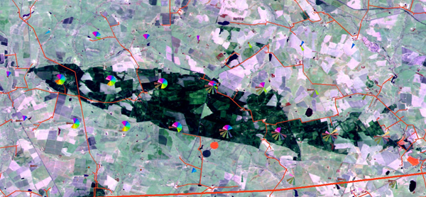
Forest Mapping
SANSA proactively supports government departments with forest maps and vegetation biophysical variables that can show vegetation stress, chlorophyll content and general health conditions at a national scale to support effective environmental management. The biophysical parameters generated regularly at a national scale to support environmental scientists are: Leaf Area Index (LAI), Fraction of Absorbed Photosynthetically Active Radiation (fAPAR) and Normalised Difference Vegetation Index (NDVI) base layers.
Forests play a critical role in combating the impacts of climate change, but are threatened by the expansion of settlements, mining, forest and veld fires, and agriculture. Earth observation technology provides actionable near-real time information at a large scale for sustainable forest management and conservation.
Water Resources Management
SANSA Earth Observation technology makes it possible to monitor freshwater bodies in near-real time. From this information SANSA produces an annual water layer, and provides country-wide coverage of seasonal water body base layers for the Department of Water and Sanitation and other water authorities.
Understanding the distribution of freshwater bodies assists in planning water distribution, and integrated environmental management and planning. Freshwater resources continue to be threatened by climate change and human activities, resulting in decreased water supply and poor-quality water. Additionally, the water quality in small municipal water bodies tends to be overlooked, thus resulting in even more shortages of freshwater in rural municipalities of South Africa.
Future research will assess and map water quality assessment at the municipal level, as well as map the relationship between water quality and water-borne diseases.


