Support Action SA/2020/1: Closing Date- 15 March 2021
 Focus: Innovative Earth Observation Approaches to Sustainable Urban and Rural Development;
Addressing: SDG 11 Sustainable Cities and Communities: Make cities and human settlements inclusive, safe, resilient and sustainable.
Primary Activities and Outputs: South Africa is rapidly urbanizing with more than 63% of its population living in urban areas and this number will rise to 70% by 2030. This will put a lot of pressure on the natural environment, services and infrastructure, calling for adequate and effective urban planning. The growth of cities also results in degradation of natural habitats, changes in species composition, cities micro-climate, energy flows and subsequently creating urban heat islands. The realization of the Human Settlements Vision 2030, on the road to 2050 requires effective and sustainable urban planning and development management, supported by adequate and up-to-date geospatial information base.
Earth observation technologies provide opportunity to map, monitor and inform human settlement-related dynamics, providing valuable geo-spatial information on the interaction between human activities, the built environment, natural habitats and climate. Proposals are requested to develop innovative earth observation-based approaches to improve decision-making for sustainable urban and rural development in South Africa. Proposals should seek to maximise the value of available earth observation data through new analytics, data fusion, quantitative knowledge addition or other innovative approaches. Proposals must use a multi-product approach, utilising data from at least two satellite-derived product types. There must be a strong focus on high level metrics or indicators – whilst proposers have significant flexibility in choice of these metrics, there must be strong justification, demonstrated innovation and high potential impact value.
Domain Development Action DDA/2020/1: Closing Date- 15 March 2021
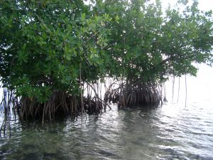 Focus: Development of new High Resolution Water Quality Observation Capabilities for Coastal and Estuarine Systems
Primary Activities: Coastal ecosystem services are of national importance as they impact on food security and agriculture, human livelihoods, and trade and industry. Water quality is critical to these coastal ecosystem services, impacting upon the ability to sustainably exploit and conserve ecosystem functionality. Marine biodiversity, fisheries, tourism, infrastructure and the built environment within coastal areas have all been identified as sectors requiring specific interventions to ensure that the oceans and coastal environment continues to deliver goods and services to society. Such services include extractive resource use, abstraction and discharge, fisheries, aquaculture, and tourism. Water quality can be compromised by any combination of anthropogenic activities such as domestic and industrial wastewater, solid waste, contaminated storm water run-off, climate change – and natural phenomena such as harmful algal blooms.
In the last few years, the availability of free data from relatively high-resolution sensors (<1km), such as Sentinel 2 and Sentinel 3, provided the potential to provide high-frequency water quality information on a routine basis at appropriate scales. Whilst this operational potential has been realized to some degree for South African freshwater systems, through programmes such as the Earth Observation for National Eutrophication Monitoring (EONEMP), there is currently no routine high-resolution capability for South African coastal and estuarine waters. Proposals are requested to further develop such a coastal water quality capability, as an integrated component of the Oceans and Coastal Information Management (OCIMS) project.
Proposals are requested to undertake the development of new high resolution (<1km) near coastal and estuarine/embayment water quality products, based primarily on the Sentinel 2 and Sentinel 3 Full Resolution (FR) sensors. These products are expected to be integrated into the existing Oceans and Coastal Information Management System (OCIMS) Water Quality Decision Support Tool, with appropriate development of the relevant OCIMS front end. Proposals should also recognize analogue systems under development for inland water quality monitoring and seek to establish some first order synergy between the initiatives for estuarine applications.





 Focus: Innovative Earth Observation Approaches to Sustainable Urban and Rural Development;
 Focus: Development of new High Resolution Water Quality Observation Capabilities for Coastal and Estuarine Systems
 Focus: Artificial Intelligence and Earth Observation: Roadmap to Establish Cross-Sector Value and Approaches;
 Focus: Earth Observation and Disruptive Economics: Developing Smart Tools for Value Enhancement for Small Scale Food Production
 Focus: Development of New Hyperspectral Capabilities across Terrestrial, Aquatic and Atmospheric Domains

