
07 Apr Space solutions support Government’s COVID-19 containment
The COVID-19 pandemic has been described as the greatest challenge that the world has faced since the second world war. Its impact, in terms of both loss of life and reduced economic growth, has been devastating. South Africa, although at an early stage of the pandemic, is entering uncharted territory with increasing rates of infection. A key factor in the fight against the pandemic is the rapid availability of appropriate information in the hands of key decision makers.
Gauteng informal settlements
The South African National Space Agency (SANSA), through its twin mandates to acquire, disseminate and distribute space based data and information for decision making, as well as coordinating the South African Space Sector, is aligning itself and the South African Space Sector’s capabilities and capacities towards the fight against COVID -19. The objective is to provide decision makers with relevant space derived spatial information and tools to support evidence based decision making in their efforts at implementing a national response to mitigate the COVID-19 pandemic.
This space derived spatial data and information will be sourced from both government agencies and SANSA’s partners in the private sector and will be provided to the various government agencies charged with managing the spread and response to the pandemic and the Department of Science and Innovation COVID-19 research platform. “Government’s historical investment in science, technology and innovation can now be harnessed for a national response to a global pandemic, which brings to the fore the importance of these investments for addressing our socio-economic-environmental challenges and where SANSA is one of many such entities that is able to respond to the current crisis”, says Dr Munsami, the CEO of SANSA.
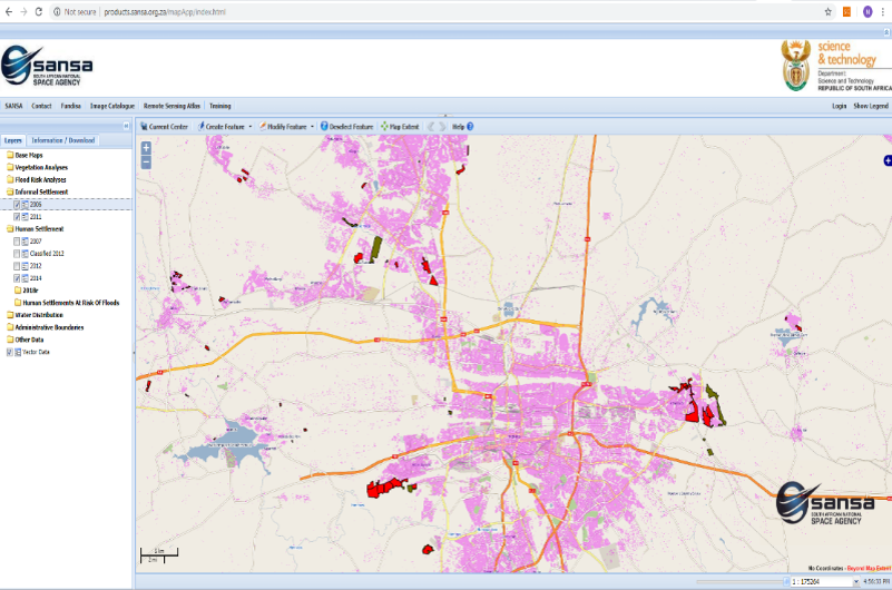
Data visualisation and monitoring tool
Key to fighting the pandemic is developing an understanding the spatial extent of the pandemic that include the population spread and its density mapped at household level, the patterns of movement of people and the location of communities at risk and households, especially in rural areas. This knowledge could assist with the planning deployment of medical workers for widespread screening and testing, social development through water and sanitation services and national security amongst others. In this regard, tools and information products that SANSA and its industry partners are providing include:
- Origin to destination analysis of vehicle traffic movement on South Africa’s major routes in the days leading up to and after the lock down period to identify the movements between urban and rural areas, and thereby determining potential infection hotspots.
- Human Settlement layers which includes urban and rural density maps that will assist with the planning of appropriate resource deployment. The datasets further provide location information at household level to assist with the COVID Home Visits Programme and deployment of necessary services especially in informal settlements and rural areas.
- Monitoring of climate change, in particular air quality, across South Africa as a result of the lock down.
In addition to these tools and information products, SANSA intends to leverage the space based information knowledge located in institutions of higher education, government agencies and science councils along with the private sector by launching a call for solutions (proposals) that demonstrate impactful services that respond to containing the spread of the coronavirus.