10 Mar Sentinel-2B for enhanced decision-making in agriculture and food security

The successful launch of Sentinel 2B on the 7th of March 2017 provides the users with great wealth of data required to monitor the environment and manage food security. Sentinel 2B is part of the sentinel 2 mission that carries an innovative wide-swath high-resolution multispectral imagery with 13 spectral bands perspectives of our land and vegetation.
Sentinel 2A was launched on 23 June 2015 and has been contributing to a number of national, regional and international initiatives on agriculture and environmental management.
SANSA has been using Sentinel 2A imagery to biophysical parameter and products to support improved management of food security in the country. The launch of Sentinel 2B will increase the frequency of data updates and help decision makers and the farmers put necessary measures for food sustainability and food security. The figure below shows percentage of planted land area at a selected area of interest.
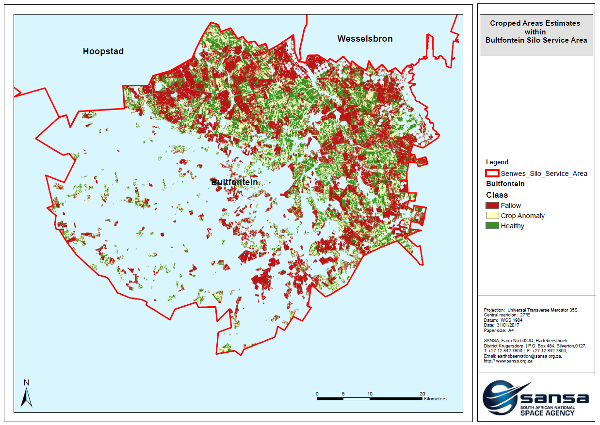
This product is used by users to identify planted land, monitor crop development and estimate yield which assist in managing food security in the country.
In addition to agriculture, Sentinel 2 missions provided high revisit time required for disaster management map and land cover and land use mapping. Preparations to host a mirror archive of Sentinel images at SANSA to enable easy access to the users are currently underway.