15 Nov Space technology in flood prediction

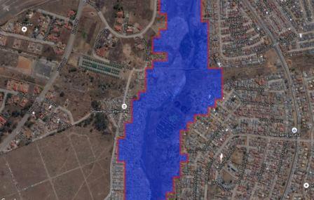
Setjwetla informal settlement in Alexandra Township
With the devastating flash floods that occurred in Gauteng last week and expected heavy rainfalls in the coming days, it is important for our citizens to know about flood prone areas and take precautionary measures on time, to mitigate the impact on infrastructure damage and possible loss of lives.
SANSA has developed a flood risk map that contributes to disaster early warning systems and post planning events. This system allows you to identify if the areas you reside in are within the demarcated flood risk zones, which are shown in red on the map. In light of the recent floods, the map provided will be vital in increasing floods awareness on the risk areas. The flood monitoring system is used mainly by the national disaster management council (NDMC), who then distributes it to other government departments and municipalities.
The image above shows the areas that have already been affected by floods. This area had been flagged as a high risk zone in the flood risk map.
For more information on the flood risk map and available Earth onbservation products/ offerings at SANSA, please visit the following link.
http://products.sansa.org.za/mapApp/index.html